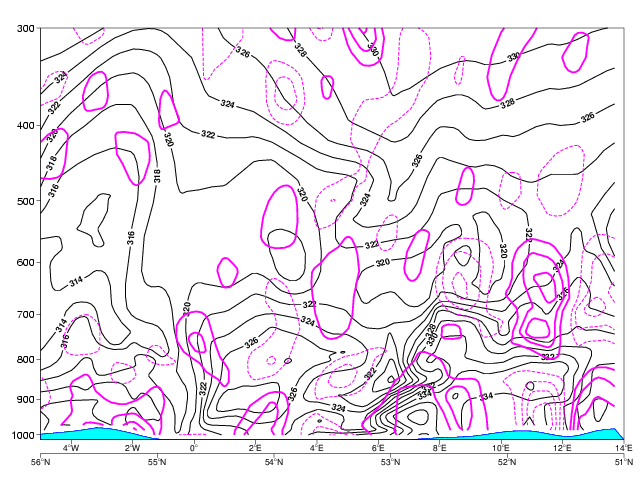
Divergence
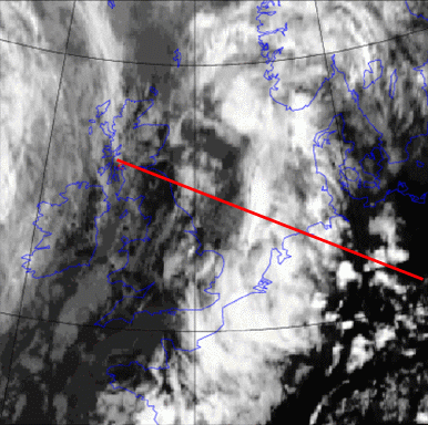
This cross section shows clearly high potential instability over Germany (between 6° and 12°E). The vertical orientation of the maximum values of the equivalent potential temperature shows the position of the convergence near the surface and a divergence in middle altitudes (8 to 10°E). The satellite image shows here frontal cloud bands. From 11° to 12°E we see a divergence near the surface and a convergence in higher levels equivalent to a stabilisation tendency at this time and in this region. East of 12°E the image reveals near the surface convergence and divergence in upper levels. The convergence between 10 and 12°E corresponds well with surface measurements.