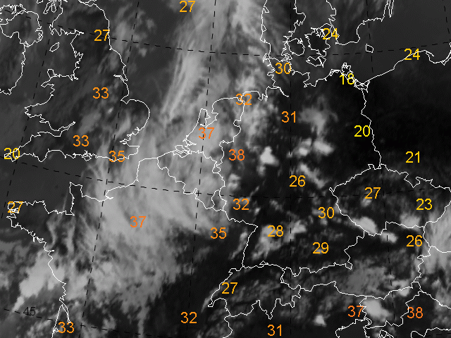
The precipitable water considered here is the integral from surface to 400 hPa of the mixing ratio of water vapour to the mass of dry air.
The image of precipitable water (in mm) reflects the large scale airmass contrast which we have already seen in the Airmass RGB images. There is a clear gradient of decreasing values from Southwest to Northeast.
This reflects the transition from subtropical and humid air that has already reached the western parts of Germany and dry and very warm air farer to the East. Values of partly more than 35 mm are an indication for heavy precipitation.
The 'Pseudopotential temperature' gives a similar image.