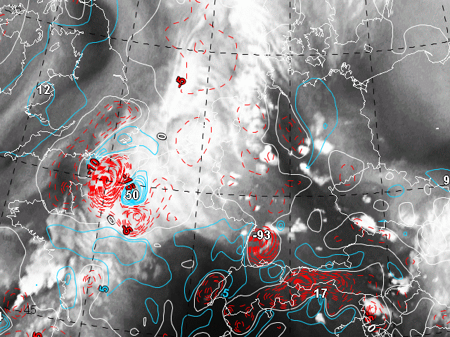
This chapter shows the cloud configurations in WV satellite images in relation to the vertical motion expressed as Omega in 500 hPa. Red colours indicate negative values (upward motion), blue colours mark areas of positive Omega (downward motion).
The dark stripe in WV-image from northwestern Germany to Slovenia is a very instructive example for the conceptual models "Enhancement of convection by PV" and "Convective cloud features at the leading edge of frontal cloud bands". An example for the latter can be seen over the western part of Germany (West to Southwest of the dark stripe). Here we find also upward motion. (The high value of -93 related to the Black Forest should not be considered too seriously.)
East of the dark stripe we find upward motion and convective cells, too. However, they can be explained with the conceptual model "Enhancement of convection by PV". The corresponding image in the chapter IPV 310 K shows for 12 UTC relatively high values of IPV.