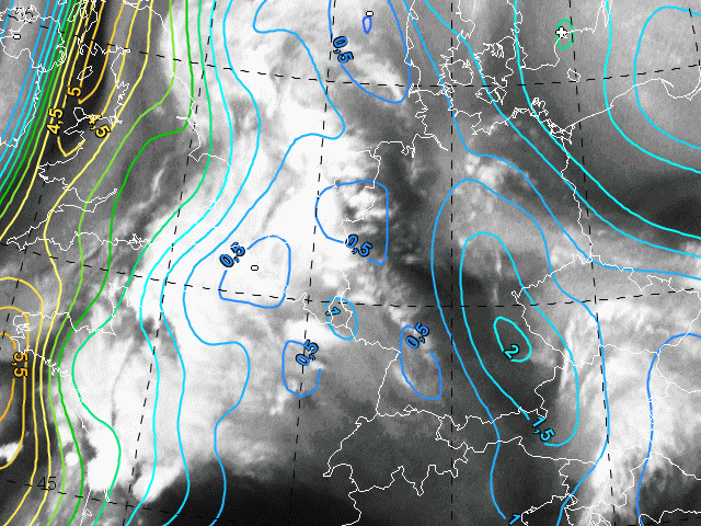
In order to demonstrate that WV images (in relation to IPV) deliver good hints to possible thunderstorms, first we consider also 06 UTC. For demonstration, we also take the area over western Europe (west of the frontal clouds) into account.
This image shows a dark stripe from the North Sea to eastern Italy. On its eastern edge we observe relatively high IPV. That is a typical constellation of the conceptual model "Enhancement of convection by PV". Although we do not see severe convection yet, we should be aware that during the next few hours thunderstorms could develop.
West of this dark stripe we see some convective cells. However, this convection is according to the conceptual model "Convective cloud features at the leading edge of frontal cloud bands".
For demonstration we consider the western edge of the image. We see a long North to South oriented area with greyish or dark WV pixels and in connection to that high IPV. Because the PV anomalies were moving to the East We should expect that east of the IPV maxima convection could start or intensify.