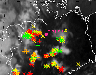
Lightnings 11:30-12:00 UTC
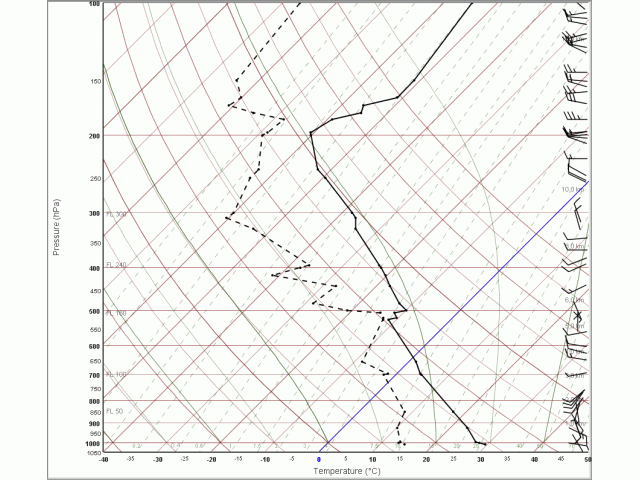
At 12 UTC this radio sounding station is situated in front of a convective system with thunderstorms moving eastwards. The thunderstorm activity passed the station during the next hours. The left image shows typical structures for a prefrontal situation likely to thunderstorm:
We find a significant right turn of wind direction from surface to about 3 km above ground that is equivalent to warm air advection. Measurements above 3 km exhibit only weak temperature advection. This implies an increasing vertical temperature gradient during the next few hours. Because we observe already potential instabillity (KO-index was -2) it is likely that the potential instability will increase, too. If upward motion is superimposed, thunderstorms are likely.
This sounding does not give hints for super cells (not discussed in this case study, can be derived from the parameters 'Bulk Richardson Number' and 'Storm Relative Helicity').