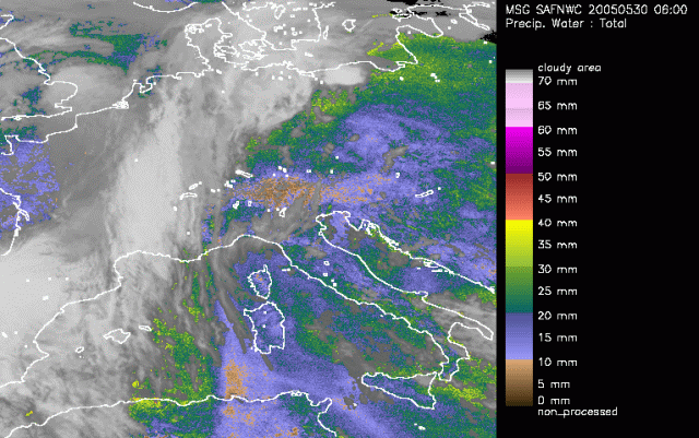
Ahead of the frontal system over Western Europe several colours are identified. Highest values for the TPW are found just ahead of the front (green colours) with maxima just over Algeria and also over northern Poland connected to the convective cells embedded to the frontal system in that region. The area of interest is found over the Alps and the Czech Republic. The Alps themselves show lower values for TPW that can be explained by the geography. Further to the east more blue colours are observed. They indicate values up to 20mm of potential rain.
Around 0930UTC we see an intensification of the yellow colours over Central Poland. This is also where at a later stage severe convection is taken place. The signals now already indicate the amount of moisture that is potentially available. Further to the south the convection over Austria is obscured by some low clouds. The colours however still indicate values up to 20mm.