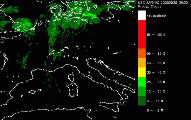
The product provides probability results, i.e. probabilities of precipitation intensities in pre-defined intensity intervals. From the probabilities a categorical estimate of precipitation intensity may be derived. It is not intended to provide information on the type of precipitation.
In the first image we see the likelihood of precipitation within the frontal system increasing northward. This increase continues as especially in the next few hours more areas with high probability of precipitation are detected. Over the North Sea a patch of high clouds (see Cloud Type) is identified with high likelihood of rain. Around 1030UTC the first Cbs emerge just north of the Alps in Austria. This is well picked up in this product as an increase in the chance of precipitation. This chance increase during next few hours considerably.