RR = factor (IR10.8,VIS0.6, WV6.2)
During night only WV and IR information is used. The WV brightness temperature is a useful parameter for extracting deep convective clouds with heavy rainfall. Some model data is used as input in the form of relative humidity at 700 hPa.
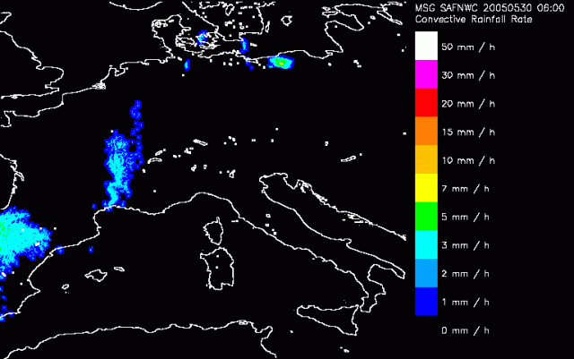
In the first image we can identify three large regions which are marked by convective rain. Over Spain convective cells are embedded into the frontal system likely to produce rain. This in accordance with ASII, but also with the surface observations. Further north over France also a large area with CRR is recognised. To what extend the rain in this area is convective however is questionable. In other images we already saw that these clouds are probably lee clouds producing large amounts of rain in this area but have simply no convective background.
Even further north in Poland the sharp boundary of a convective cell is observed that is producing about 7mm of rain over the last hour. This is in full accordance with the thunderstorms that were observed at that step in time.
In the following slide we see the front slowly moving eastward. Embedded still a large area with rain, where the most active part is still found just north of the Alps assuming lee clouds. Around 12UTC the first cells just north of the Alps in Austria emerge. Immediately high values for the Rain Rate are diagnosed.