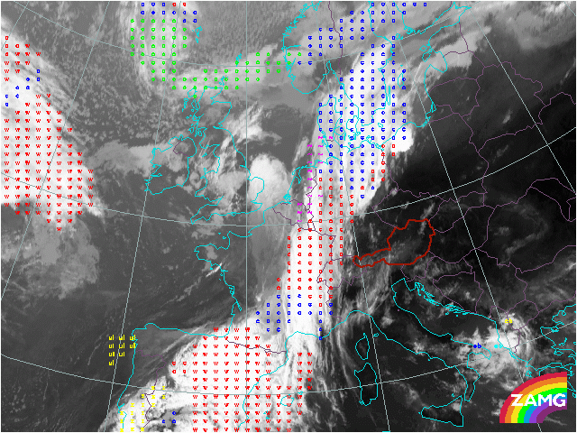
30 May 2005/06.30 UTC - Meteosat IR10.8 with ASII NWP overlay
Up till this point the products of the NWC SAF thus seen only identified and characterised the areas in the cloudfree regions. Two products that identify and characterise clouds are ASII and ASII-NWP. Where ASII-NWP stands for Automatic Satellite Image Interpretation. Where the data from MSG SEVIRI satellite are supplemented by typical key parameters from the numerical model output of ECMWF
The basic concept of ASII-NWP is the identification of:
- Detection of frontal areas
- Detection of S-shaped lines
- Detection of circular-shaped cells
- Detection of narrow cloud fibres
- Detection of black stripes in WV images
- Detection of spiral cloud structures
- c stands for Cold Front
- w denotes the Warm Front cloudiness
- ul indicates an upper level low.
- ~ is the sign for a developing wave on the cyclonic side of the frontal band.