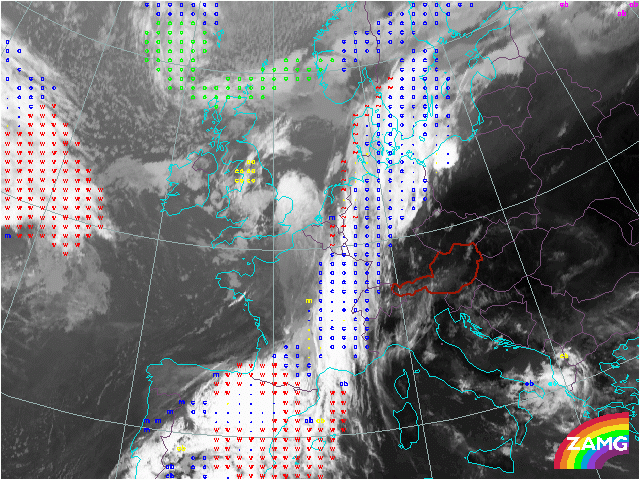
30 May 2005/06.30 UTC - Meteosat IR10.8 with ASII overlay
Up till this point the products of the NWC SAF thus seen only identified and characterised the areas in the cloudfree regions. Two products that identify and characterise clouds are ASII and ASII-NWP. Where ASII stands for Automatic Satellite Image Interpretation.
The basic concept of ASII is the identification of:
- Detection of frontal areas
- Detection of S-shaped lines
- Detection of circular-shaped cells
- Detection of narrow cloud fibres
- Detection of black stripes in WV images
- Detection of spiral cloud structures
- c stands for Cold Front
- • for the embedded convective cells in the Cold Front
- w denotes the Warm Front cloudiness
- m indicate convective cells, where the yellow colour represents the mature cells, a magenta colour for the developing cells and blue colour for decaying cells.
- ~ is the sign for a developing wave on the cyclonic side of the frontal band.
Around 11UTC the convection ahead of the front is about to start. North of the Alps the first cells just emerged and are positively identified as Cbs. The magenta colour again indicates that these cells are still developing and should be looked at in following timesteps.