Authors
LCRSAndré Obregón
Jan Cermak
Jörg Bendix
DWD
Wilfried Jacobs
Introduction
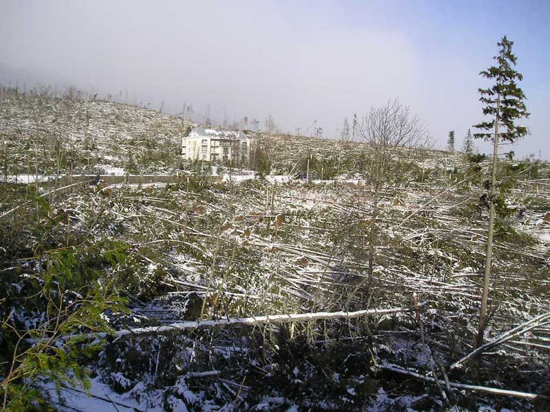
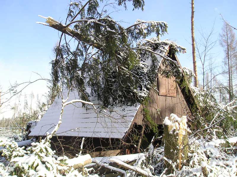
In November 2004 a rapid cyclogenesis took place over central Europe. The cold front crossed central Europe in NW direction and brought intense precipitation in these areas. Strong gusts in Germany were restricted to higher regions. The storm reached its maximum on 19 November in the Tatra Mountains (Slovakia, southern Poland) where winds were orographically strengthened. On the lee side of the High Tatras, wind speeds reaching about 80 to 100 kn in gusts were measured. Pictures of the devastation caused even suggested wind speeds above 100 kn. The Tatras National Park on the southern lee side of the High Tatra Mountains suffered serious damage. An area of about 10.000 km˛ forest was destroyed, leaving behind flat land with fallen trees. Many roads were blocked and electric power supply was interrupted. The storm damaged a number of buildings, blocked public transport and for several days cut off a number of people from the outside world. Two people were killed. (Source: Storm in Tatras National Park).
|
|
The case study follows the development of a rapid cyclogenesis event with its origin over the Atlantic Ocean. Over central Europe an advanced stage of the Rapid Cyclogenesis can be observed. The mature stage is reached over eastern Europe, represented by the development into a huge cloud spiral moving over Russia.
The left-hand image below shows the initial stage of the rapid cyclogenesis with a W-E oriented cloud band and a typical low level cloud head on its poleward side over Great Britain (see arrow). The image to the right shows the advanced stage. A small dark area (see arrow), typically connected to rapid cyclogenesis, indicates downward protrusion of upper air clearly seen behind the SW-NE oriented cold front over southern Germany. Upper air processes and a strong jet stream play key roles in the development of this case.
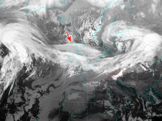
Initial Stage: 18 Nov 2004 09UTC - Meteosat-8 IR10.8 |
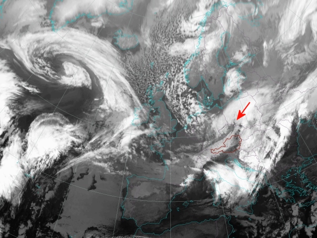
Advanced Stage: 19 Nov 2004 09UTC - Meteosat-8 IR10.8 |
The aim of this case study is to:
- Follow the development of a rapid cyclogenesis by studying IR and WV satellite images as well as RGB composites
- Investigate the dynamical background by considering derived meteorological parameters
It is recommended to study the conceptual model of a 'Rapid Cyclogenesis' from the 'Manual of Synoptic Satellite Meteorology' before going into this case.
Following parameters are considered key parameters and will be discussed within this case study:
- Geopotential height at 1000 hPa
- Temperature advection at 700 hPa
- Positive vorticity advection at 500 and 300 hPa
- Isotachs at 300 hPa
- Height of PV = 1 unit
In order to obtain a better insight into the relevant dynamical processes, a number of supporting parameters will be considered in the chapters 'Synoptic Situation' and 'Vertical Cross Sections' respectively:
- Geopotential height at 500 hPa
- Divergence
- Vertical motion
- Relative humidity
LCRS - Laboratory for Climatology and Remote Sensing
Faculty of Geography, University of Marburg
Germany